1. What Is GS1:locationInfo
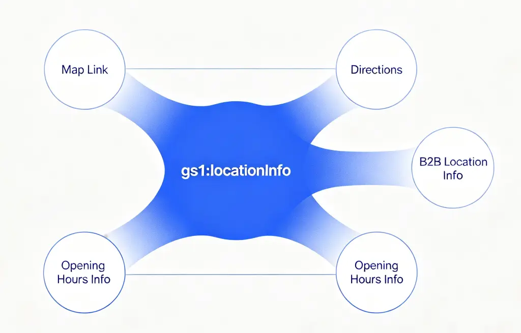
gs1:locationInfo is one of the standardized link types in GS1 Digital Link, used to connect an entity with its location-related information. Per the GS1 Web Vocabulary definition, it is “a link to maps, directions, or other location-related information.”
The basic idea behind GS1 Digital Link: GS1 identifiers like GLN and GTIN are converted into standard Web URIs, giving every entity (location, product, organization) a resolvable network address. The same identifier can point to multiple information sources.
gs1:locationInfo provides one specific entry point: location information. The page it points to typically includes:
- Map location: geographic coordinates of stores, warehouses, factories, offices
- Directions: how to reach the location
- Parking information: parking lot location, fees
- Accessibility: wheelchair ramps, elevator locations
In the link type system, gs1:locationInfo has a clear division with a few related types: locationInfo answers “where,” gs1:openingHoursInfo answers “when is it open,” gs1:logisticsInfo answers “B2B logistics details.”
2. Users and Value
2.1 Brands and Retailers: Fewer Phone Calls, Fewer Repeated Answers
Pain point: Customers can’t find the store and call for directions; staff repeats “how to get here” over and over.
What gs1:locationInfo does:
- Customers scan and see the map and directions — no need to call
- When a store relocates or an entrance changes, just update in the cloud; no re-printing
- Chain brands can configure independent
locationInfofor each store’s GLN, so scanning shows the current store’s precise location
2.2 Consumers: From “Figuring It Out” Straight to Navigation
Pain point: Addresses printed on packaging are text — you have to manually type them into a navigation app; describing a shop’s position inside a mall is hard.
What gs1:locationInfo does:
- Scan and jump directly to a map app; one tap starts navigation
- For shops inside malls, it can show floor, zone, nearby stores — indoor location info
- Foreign tourists scanning automatically see directions in their own language
2.3 Logistics and Supply Chain: Standardized Location Data
In B2B scenarios, gs1:locationInfo can provide standardized location entry points for warehouses, distribution centers, factories, and other logistics nodes. Logistics partners scan to get:
- Precise locations of loading and unloading docks
- Specific routes into the warehouse
- Vehicle restriction info and best arrival times
2.4 Location Information That Can Be Updated Anytime
Traditionally printed location info — store addresses on packaging, route maps in brochures — is fixed once printed. Store relocations, entrance changes, temporary construction — none of that can be reflected on already-printed materials.
With gs1:locationInfo, the QR code stays the same, but the location information behind it can be updated anytime. One update in the resolver backend, and every QR code in circulation points to the latest location.
3. Typical Use Cases
Case 1: Chain Retail — Scan-to-Navigate Store Directions
A chain coffee brand prints GS1 QR codes with gs1:locationInfo on every store’s cup sleeve, menu, and loyalty card (linked to the store’s GLN). Customers scan and see:
- The current store’s precise location on the map
- Walking or driving directions from their current position
- Store entrance location (e.g., “Ground floor of the mall, east side, near Uniqlo”)
- Parking information (if available)
For stores in large malls or complex buildings, gs1:locationInfo can also provide indoor navigation guidance.
Case 2: Brand Experience Center — Connecting Product to Space
A premium appliance brand prints GS1 QR codes with gs1:locationInfo on every product, pointing to the brand’s experience centers around the country. Consumers scan after purchase:
- Find the nearest experience center
- Get directions there
- Learn about services offered (product trials, after-sales consultation, accessories purchase)
This connects the product purchase with offline experience — extending value from “owning the product” to “experiencing the brand.”
Case 3: Logistics and Warehousing — Precise B2B Location Guidance
A large logistics company posts GS1 QR codes with gs1:locationInfo at the entrance and loading zones of every distribution center (linked to the warehouse GLN). Freight drivers scan to see:
- Precise location of loading and unloading docks
- Route into the facility (avoiding restricted zones)
- Waiting and parking area
- Warehouse entrance guidance
This cuts down driver wait time from lost routing, improving efficiency across the logistics chain.
Case 4: Healthcare Institution — Navigating the “Last Mile” to Care
A large hospital uses GS1 QR codes with gs1:locationInfo on visit cards, appointment texts, and in-facility signage (linked to GLNs for different buildings). Patients scan to see:
- Which building and floor the target department is in
- Indoor navigation route from the hospital entrance
- Parking and elevator locations
- Accessibility route information
In large general hospitals, patients often feel anxious when they can’t find a department. gs1:locationInfo brings indoor navigation to the patient’s phone, easing that anxiety.
4. Full Usage Example
Here is a JSON example of a chain coffee brand configuring gs1:locationInfo for a store:
{
  "anchor": "/414/06933960552835",
  "itemDescription": "CloudBrew Coffee - Shanghai Nanjing West Road",
  "defaultLinktype": "gs1:locationInfo",
  "links": [
    {
      "linktype": "gs1:locationInfo",
      "href": "https://locations.example.com/shanghai/nanjing-west",
      "title": "Store Location & Directions",
      "type": "text/html",
      "hreflang": ["zh-CN"],
      "context": ["consumer", "navigation"]
    },
    {
      "linktype": "gs1:locationInfo",
      "href": "https://locations.example.com/en/shanghai/nanjing-west",
      "title": "Store Location & Directions",
      "type": "text/html",
      "hreflang": ["en"],
      "context": ["consumer", "navigation"]
    },
    {
      "linktype": "gs1:openingHoursInfo",
      "href": "https://locations.example.com/shanghai/nanjing-west/hours",
      "title": "Opening Hours",
      "type": "text/html",
      "hreflang": ["zh-CN"],
      "context": ["consumer"]
    }
  ]
}
Field Descriptions
| Field | Meaning |
|---|---|
anchor | Router anchor. The 414/ prefix followed by the GLN indicates this is a location entity. |
defaultLinktype | Default fallback link type; scans prioritize gs1:locationInfo. |
linktype | Link type; here it is gs1:locationInfo. |
href | URL of the location information page, including map and directions. |
title | Link title for display in tools. |
type | Content type, typically text/html. |
hreflang | Language preference; returns the corresponding language version. |
context | Context tags for distinguishing different uses. |
User Scanning Flow
- Scan: Customer scans the GS1 QR code on the cup sleeve or menu using a GS1 Digital Link–capable tool (phone camera, WeChat, etc.).
- Resolve: The scanning tool sends a request to the resolver, which matches the
gs1:locationInfolink based on parameters. - Redirect: The user is directed to the store’s location information page.
- Navigate: The user views the map and directions, then taps to launch their phone’s map app for navigation.
Advantages
- Minimal QR code: Only contains the GLN base path; location data lives in the cloud.
- Dynamic routing: Returns Chinese or English location info based on
hreflang. - No re-printing: Store relocations or entrance changes are updated in the backend only.
- Works with opening hours: Pairs with
gs1:openingHoursInfoto show both “where” and “when.” - Data analytics: The resolver backend tracks visits to each
gs1:locationInfolink.
Summary
gs1:locationInfo directly serves location navigation. It standardizes one question: “How do I get there? Where is it?” The product page answers “what is this,” the opening hours page answers “when is it open” — gs1:locationInfo answers the last question before arrival.
Chain retail doing scan-to-navigate, brand experience centers connecting product to space, logistics companies optimizing driver routes, hospitals easing the anxiety of finding the right department — across scenarios, gs1:locationInfo provides a standardized way to distribute location information. One scan, and the journey has a starting point.